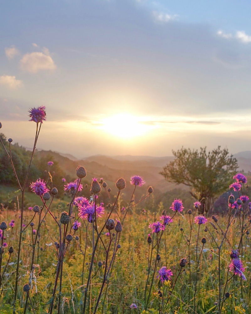
Hiking
There are almost 300 km marked paths and many improvements regarding education and infrastructure have been completed in last few years to make make the paths even safer and more enjoyable for hikers.
We recommend for you to visit the Tourist Information Office in the center of Bajina Bašta for maps and personal recommendations, especially if you haven’t visited the area before.
You can find the Google Map coordinates for the office HERE. You can find all hiking tracks HERE.
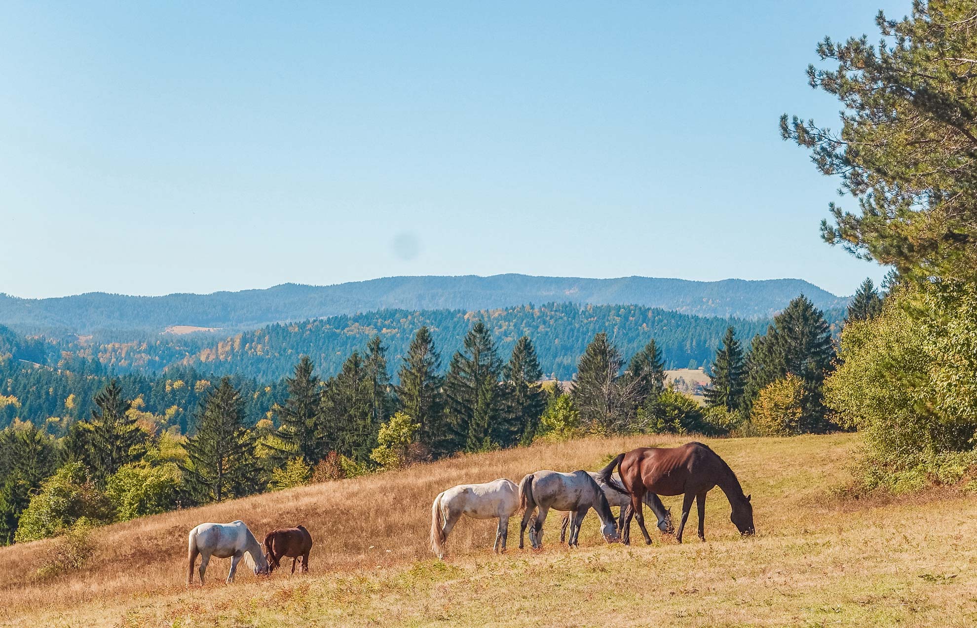
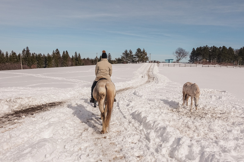
Horse riding
There are several horse farms within the national park with affordable prices so we recommend you to explore them. The prices vary between 2,00-12,00 euros.
In the neighbourhood of the apartments and Crnjeskovo viewpoint there is one we think highly of ‘Konjički klub Dora’. The Google Map coordinates for the horse farm can be found, HERE.
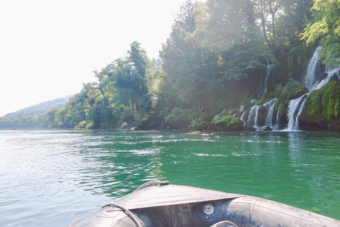
Rafting and fishing
Rafting
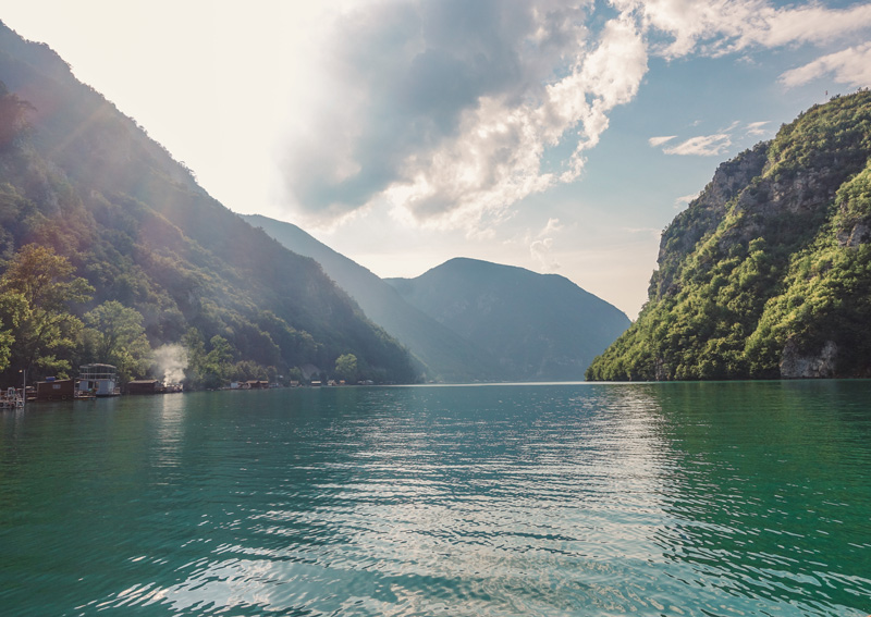
You can take a boat ride on lake Perućac and explore either the lake itself or take the ride all the way to Višegrad, test kayaking and rafting at river Drina, stand up paddle boarding on lake Zaovine and much more.
Fishing
While for fishing on river Drina you need specific permissions, you don’t need them for lake Perućac and lake Zaovine. Famous spots are “Spaići” and “Beli Rzav”. Some species that you can catch here are catfish, carp, pike and trout. You can find more information about this HERE.
Cycling, quad driving and bear watching
Cycling
There are three official and marked cycling tours. They use existing public and forest roads and can be used as hiking routes as well. These tracks are a part of wider Western Serbia biking routes network. Find more HERE.
Rent a quad
It’s possible to rent a quad and drive around and explore the national park that way. Find more information about renting a quad HERE.
Bear watching
There are over 50 brown bears. You have a unique opportunity to admire them in their biggest natural habitat in Serbia from safe, specially designed observation hides. Get more information HERE.
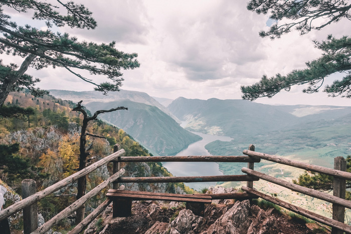
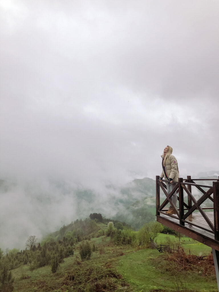
Banjska Stena viewpoint
One of the tourists favourite places to visit! This panorama point is very famous and an absolute must-see. It is directly on top of river Drina and lake Perucac but in a 1000-meter altitude! The Google Map coordinates for Banjska Stena can be found, HERE.
Crnjeskovo Observation Deck
Crnjeskovo is the closest viewpoint from the apartments. It has a 2000-meter clearly marked walking path. The path goes through a forest. After you finish your hike, you can stop at a church where you can also buy some local honey and other goodies. The Google Map coordinates for Crnjeskovo can be found, HERE.

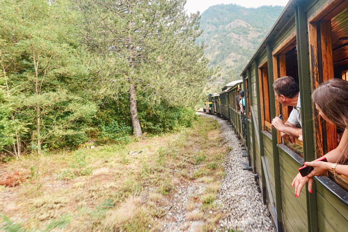
Šargan Eight Train Ride
Šargan Eight connected Belgrade to Sarajevo from 1925 until 1974. Nowadays it serves as a railway museum. The route the train takes is a shape of an eight which makes it hard for passengers to know what it has passed and what is yet to come. The ride is approximately 3 hours long and surrounded by magnificent scenery. Google Map coordinates for the destination are HERE.
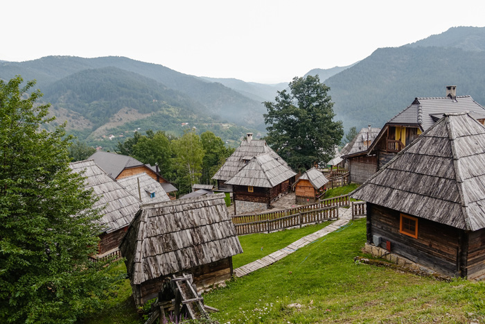
Ethno Village Drvengard in Mokra Gora
Drvengard has been contributed by the Serbian movie director Emil Kusturica also known internationally and from the Cannes Movie Festival. He relocated all the traditionally built houses from nearby areas. Google Map coordinates for the destination are HERE.
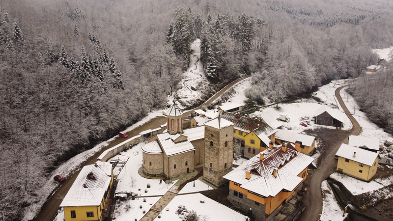
Monastery Raca and Spring Ladjevac
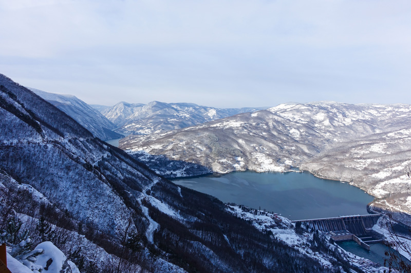
Zelenika and Kozija Stena (‘Goat Rock’)
You can catch this view when driving from Lake Perucac to Mitrovac. You now have designated benches and arches for taking pictures on the Vidikovac Zelenika. Google Map coordinates are HERE. You can see the Lake Perucac and river Drina from high altitude, as well as the dam.
Just a little bit higher up you have the Goat rock which is the original viewpoint. The Google Map coordinates for the viewpoint can be found, HERE.

Surroundings of Lake Zaovine
The surroundings of Lake Zaovine are full of green hills and beautiful landscapes as well as tiny mountain villages. The Lake is manmade, built after a dam was created nearby. Enjoy nature or swimming in the lake. The Google Map coordinates for the destination are HERE.
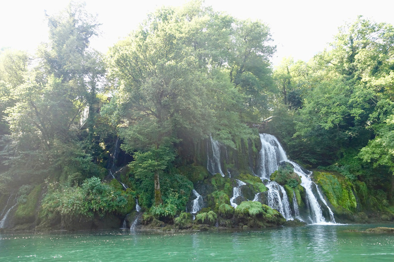
Vrelo
Vrelo is the shortest river in the world. It’s 365 meters long and that’s why it’s called a year river. You can walk to its starting point and on the other end there is a restaurant on top of a waterfall. The Google Map coordinates are HERE.
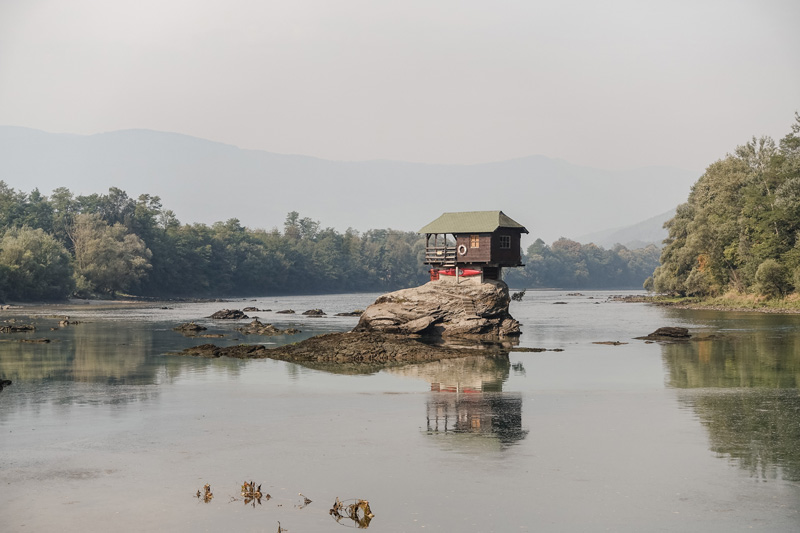
Drina House viewpoint
The Drina House is one of the most famous sights. It has a wooden deck for admiring the view. There is also a restaurant Studenac right above. The Google Map coordinates for the destination are HERE.
Gate of Podrinje
This viewpoint is the entrance for the River Drina. This is one of the most breathtaking views of the hills, small villages and nature. This spot locates just before the town of Bajina Bašta. The Google Map coordinates for Gate of Podrinje can be found, HERE.